Digitaria ctenantha is unique in the Digitaria genus in Australia in that the pedicelled spikelet in the spikelet pair has a row of bristles/stiff hairs along the margin with a wing extending along their bases – ktenos is Greek for comb.
The sessile spikelet (see lower pic) can be seen to have a few bristles but the upper margin in this image is fringed by a row of soft hairs.
This specimen came from the Carmichael River area. Digitaria ctenantha occurs across the north of Australia, growing in rocky or sandy soils.
Digitaria belongs to a group of grasses (including Hymenachne and Alloteropsis) that were originally allocated to Panicum –Digitaria ctenantha was first described as Panicum ctenantha by Ferdinand Mueller in 1874 from specimens he collected in the Tanami Desert at Lajamanu in the NT (Hooker Creek), on the Gregory-led Northern Australian Expedition.
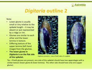
Digitaria and Panicum are easily confused – the Ausgrass2 key used the firmness of the glumes compared to the fertile lemma to split them apart, which is highly unsatisfactory for many (in Panicum the fertile lemma is ‘decidedly firmer’ in texture than the glumes, whereas in Digitaria the two are similar in texture).
I find that in Digitaria the spikelets are generally closely appressed to the main raceme axis, rather than held apart from the axis as in Panicum. Some Digitaria are densely hairy, which does not occur in Australian Panicum. In addition, the lemma of the fertile spikelet does not tuck tightly around the palea in Digitaria as it does in Panicum.
References
Australian National Herbarium, 2026, Digitaria ctenantha in Australian Plant Name Index (APNI), available at https://biodiversity.org.au/nsl/services/search/names.
Wheeler, J.R., Rye, B.L., Koch, B.L. & Wilson, A.J.G., 1992, Flora of the Kimberley Region, Western Australian Herbarium, Dept. of Conservation and Land Management, W.A..
Dichanthium setosum S.T. Blake is a rare grass listed as Vulnerable under the EPBC Act and the NSW Biodiversity Conservation Act 2016. It was delisted in Queensland approximately 10 years ago as although it is genuinely rare here, its conservation status is likely to be secure.
Dichanthium setosum is a grass that has a negative survey bias – that is, it is likely to be missed during surveys, unless the survey is targeted, undertaken in a suitable manner (that is, slowly and at a suitable intensity) and undertaken by ecologists who have a familiarity with the identification of Dichanthium species.
There are two reasons for this:
It is a cryptic grass that looks similar to the least concern species Dichanthium sericeum (specifically subspecies sericeum) and to a lesser extent D. fecundum, both of which are common components of woodland in Queensland and partially in NSW (D. fecundum does not occur in NSW and hasn’t been collected south of the St. George-Toowoomba latitude – AVH, 2026).
It has been recorded from a very broad range of habitats so it’s difficult to narrow down its likely occurrence:
In Qld it has been recorded occurring on heavy clay and black and brown clay loams and alluvia in woodland dominated by Eucalyptus crebra, E. orgadophila, E. melanophloia, Corymbia erythrophloia, E. melliodorora, E. biturbinata and C. polycarpa, associated with basalt and sandstone (AVH, 2026).
In NSW it has been recorded in loams, heavy clays and gravelly sand derived from or in association with alluvium, granite, basalt, sedimentary rock and serpentinite (a metamorphic rock), and occuring in native and derived grasslands with tree species E. albens, E. melliodora, Callitris sp., E. sp. aff. macrorhyncha, Angophora floribunda, E. viminalis and E. blakelyi (AVH, 2026).
What makes this situation even more difficult is the recent discovery of at least one Dichanthium sp. aff. sericeum, new species that have apparently been hiding (at least in central Qld) ‘in plain sight’ (N. Fechner, pers. comm., Fechner, N., pers. comm., 14/2/2018; Thompson, J., 5/3/2026).
When assessing likelihood of occurrence for D. setosum, I almost invariably assess it as ‘unlikely’, as it is unlikely to occur, even in habitat that is otherwise ‘on paper’ perfect. Even near areas where it has been recorded previously it is usually a ‘may occur’ at best.
Identification of D. setosum or at least splitting it from D. sericeum and D. fecundum IS possible in the field for ecologists with good familiarity with grasses, and this blog provides resources to assist with this.
However, the advice of John Thompson (Queensland Herbarium retired Senior Botanist) re: keying out D. sericeum and D. setosum should be kept in mind at all times: ‘In practise, for a Dichanthium key to work regarding D. sericeum and D. setosum, the specimen must be adequate and provide pedicellate spikelet anthers’ (pers. comm, 5/3/2026).
Whether this applies equally to plants collected in NSW as it does to those collected in Queensland is not clear – it is likely these species are easier to tell apart south of the border.
Importance of submitting herbarium vouchered specimens for these species
It is highly recommended that any field ID where D. setosum is considered a possibility should be supported by herbarium voucher specimens.
The taxonomy of the D. setosum and D. sericeum group (that is, species of Dichanthium with a lower glume on the sessile spikelet that has a distinct sub-apical arch of long cilia) is not well-covered by any key that is publicly available at present (eg Ausgrass2 – Simon, 2013) (Fechner, N., pers. comm., 14/2/2018; Thompson, J., 5/3/2026).
The evidence suggests there is likely to be more diversity in this group than is at present reflected in the keys, and it is unlikely a 100% reliable ID can be made by anyone other than an expert or someone with full access to the latest data on Dichanthium and experience in identifying plants in the genus.
In particular, there appears to be more diversity in the D. sericeum species concept (see comments on D. sp. aff. sericeum above) than is currently reflected in published keys (Fechner N., pers. comm., 14/2/2018).
Given the importance of making a correct allocation for these species (both a type 1 or type 2 error could result in significant problems for a project) any treatment of possible D. setosum populations that did not involve vouchered herbarium identification should be considered suspect.
Distinct sub-apical arch of long cilia
A sub-apical arch of long cilia is, as its name suggests, located just below the apex of the lower glume of the sessile spikelet.
In the picture below, the arch of long cilia (fine hairs resembling an eyelash located along the margin of a surface) is emerging from tubercles (a small protuberance) just above the white line.
The length of these cilia can be useful in splitting D. sericeum from D. setosum & D. fecundum – the cilia in the arch of D. sericeum exceed the apex of the pedicelled spikelet (5-6 mm long – see image of D. sericeum below), whereas in the latter two species those hairs equal or do not exceed the pedicelled spikelet apex (>3-4 mm long – see images of spikelet pairs below).
Dichanthium setosum and D. fecundum were first described by Stan Blake in 1944.
The type specimen for D. setosum was collected from the Guyra area in NSW, about 40 km north-west of Armidale. It was first collected in 1878 & then 1885 in central NSW.
The type specimen of D. fecundum was collected from Ayr in north Queensland (about 100 km south of Townsville). It was first collected by Ferdinand Mueller in December 1855 in the upper Victoria River district in the N.T., when he was the botanist on Augustus Gregory’s Northern Australian Exploration expedition.
Dichanthium sericeum was first described as Andropogon sericeus by Robert Brown in 1810, based on specimens collected on Matthew Flinder’s circumnavigation of Australia in August 1802 (from the Rockhampton and Gladstone areas in central Queensland). Albert Camus split it from Andropogon in 1921.
Andropogon is the genus to which Gamba grass belongs (Andropogon gayanus Kunth).
Telling them apart
Dichanthium setosum is recognisable from D. sericeum in the field by the following:
The sessile spikelet of D. setosum is >5 mm long, whereas the sessile spikelet in D. sericeum is <4.5 mm (note – the sessile spikelet is the one without an awn generally). In practice the samples that are difficult to split from D. sericeum are the ones measuring 4.5-5 mm!! If your sessile spikelet is clearly >5 mm then you should focus on ensuring you sample is not D. fecundum (note that D. fecundum has rarely been recorded south of Gympie so if you are in NSW you are likely looking at D. setosum) (Ausgrass2, Australian Virtual Herbarium).
The leaf sheath of D. setosum is glabrous c.f. D. sericeum which is usually pilose (softly hairy) but may also be glabrous according to Ausgrass2.
Dichanthium setosum racemes are usually noticeably purple c.f. D. sericeum racemes, which are light-coloured (Ausgrass2, PlantNET).
The sub-apical cilia in D. setosum do not exceed the apex of the pedicelled spikelet (i.e. they are ≤3-4 mm long) whereas those of D. sericeum are >5 mm long (the should clearly extend beyond the apex of the adjoining pedicelled spikelet). This can be seen in the images of the spikelets reproduced here.
If you have access to a microscope, the pedicelled spikelet of D. setosum has 3 stamens with anthers 2-3 mm long (this takes a bit of careful dissection) c.f. D. sericeum which has a pedicelled spikelet that is either sterile (i.e. empty) or has 2 anthers up to 1.5 mm long (Fechner N., pers. comm., 14/2/2018).
Note – the bold type above denotes information that is not reflected in any published description of D. sericeum at present. Currently, all treatments of D. sericeum state that the pedicelled spikelet is sterile. This is NOT correct.
Dichanthium fecundum should be easily distinguishable from D. setosum & D. sericeum by the absence of a ‘distinct sub-apical cilial arch’. Unfortunately, D. fecundum frequently has a sub-apical cilial arch (see last image in this blog) – whether is it ‘distinct’ or not is pretty hard to tell, and a microscope doesn’t make it any easier.
Alex Kutt, legendary fauna ecologist, gave me a key once with the following couplet leading to D. setosum and D. sericeum:
“Pedicellate spikelets with a bloody obvious sub-apical cilial arch”
Which says it all. Its gotta be bloody obvious.
Dichanthium fecundum has a pedicelled spikelet (also called a companion spikelet) 5-6.5 mm long, which is similar to the pedicelled spikelet of D. setosum, but significantly exceeds that of D. sericeum (which shouldn’t exceed 4.5 mm +/- 0.4 mm) (Ausgrass2).
Dichanthium fecundum also has stigmas that protrude distinctly at maturity. The pedicelled spikelet may be bisexual and may have an awn (it is never bisexual in D. setosum and D. sericeum)(Ausgrass2).
In addition, D. fecundum is a coarser plant growing to 1.5 m tall, whereas D. setosum is shorter (<1 m tall) (Ausgrass2, PlantNET).
In the D. setosum image above, the lower glume of the sessile spikelet is facing front with the “bloody obvious” sub-apical cilial arch clearly visible. The pedicelled spikelet (its upper glume) is visible above the apex of the sessile spikelet. Note how the sub-apical cilia do not exceed the apex of the adjoining pedicelled spikelet (c.f. those in the D. sericeum image).
In the D. sericeum image above, the lower glume of the sessile spikelet is facing front – again, the “bloody obvious” sub-apical cilial arch is clearly visible. The pedicelled spikelet is visible to the rear right side of the apex of the sessile spikelet.
In the image above, it can be plainly seen that D. fecundum can have a sub-apical arch of cilia on the lower glume of the sessile spikelet (although frequently there are no hairs in the sub-apical area at all). Apparently this arch of sub-apical cilia is NOT what is known in botany as ‘bloody obvious’. But there isn’t much in it.
Note also the stigmas emerging from the sessile spikelet ‘distinctly’ (that is, they are bloody obvious).
In the image below, the pedicelled spikelet has a short awn, indicating it is bisexual. Dichanthium fecundum is the only Australian Dichanthium in which some plants develop a bisexual pedicelled spikelet (and the only one with an awned pedicelled spikelet) (Ausgrass2). Note also the emergent stigmas and presence of a basic sub-apical cilial arch.
Dichanthium fecundum S.T.Blake (SFDanielsen 739)
The image below shows more clearly the type of ‘non-distinct/non bloody obvious’ sub-apical arch of cilia that can be found on the lower glume of the sessile spikelets of D. fecundum.
If your sample has no sub-apical arch of cilia, then out of these three it is D. fecundum (you need to ensure it is not another Dichanthium though).
If it has a sub-apical cilial arch and the sessile spikelet is <4.5 mm, it is D. sericeum.
If your sample has a sub-apical arch of cilia AND the sessile spikelet is ~5 mm long, you can use this key to split them.
Sub-apical cilia of the lower glume of the sessile spikelet greatly exceed the apex of the pedicelled spikelet (i.e. the cilia are 5-6 mm long); leaf sheath outer surface is pubescent; stigmas do not protrude distinctly at maturity from most spikelets; pedicelled spikelet is sterile (empty) or with 2 anthers
Pedicellate spikelet length 4.8-5.5 mm, with anthers 1-1.5 mm long Dichanthium sp. aff. sericeum
Pedicellate spikelet ≤4.5 mm, sterile or with anthers ≤1 mm long Dichanthium sericeum
Sub-apical cilia of the lower glume of the sessile spikelet are ± equal to or do not exceed the apex of the pedicelled spikelet (i.e. the cilia are 3-4 mm long); leaf sheath outer surface is glabrous or pubescent; stigmas protrude distinctly at maturity from most spikelets; pedicelled spikelet with 3 anthers
Plants do not exceed 1 m tall; pedicelled spikelet lacks awn and is male, never bisexual; sub-apical arch of cilia on the lower glume of sessile spikelet is well developed and consistent i.e. with no gaps Dichanthium setosum
Plants are taller than 1 m; pedicelled spikelet may have awn and is male or bisexual; sub-apical arch of cilia on the lower glume of sessile spikelet is patchy or with gaps (especially in the centre) Dichanthium fecundum
Full acknowledgement is due to John Thompson, Senior Botanist (retired) at the Queensland Herbarium, for his observation that the pedicelled spikelet of Dichanthium sericeum can be male or sterile (in contrast to current keys, which state it is sterile only), and for his observations in relation to D. sp. aff. sericeum (pers. comm. 5/3/2026). All credit for this revised key is due to John.
Any comments on this blog would be welcome and can be emailed to me at simon@astrebla.com.
All images in this blog can be downloaded and used for any purpose, with the stipulation that if published you acknowledge Simon Danielsen as the author.
References
AVH, 2023, The Australasian Virtual Herbarium, Council of Heads of Australasian Herbaria, https://avh.ala.org.au/. Accessed 6/6/2026.
Kutt, A., early 2000s, Kutt’s NQ Keys to Dichanthium and Bothriochloa. Unpublished key.
PlantNET (The NSW Plant Information Network System). Royal Botanic Gardens and Domain Trust, Sydney. https://plantnet.rbgsyd.nsw.gov.au. Accessed 30/7/2026.
If you gaze wistfully at sedges (Cyperaceae family) in the field & wish you recognised them, this is the workshop for you!
This is the only public Cyperaceae ID workshop available in Australia based on hands-on ID using a microscope and keys. As a 2-day intensive study of Cyperaceae it provides a more comprehensive sedge study program than any Australian university offers.
This workshop has a northern Australian focus but the skills and knowledge gained will be directly transferable to sedge ID anywhere in Australia.
And no matter your level of previous sedge ID experience, you will learn a lot . All material presented in the workshop is ruthlessly practical & directed towards what the field botanist/ecologist needs to know to negotiate Cyperaceae keys.
Workshops (both sedge and grass) can be booked via the Humanitix website: https://humanitix.com/au
Search events using the keywords ‘Simon Danielsen’.
Public workshops are held periodically at The Hut, 47 Fleming Rd, Chapel Hill, Brisbane. If you can book 5 or more attendees at your workplace, in-house workshops can also be arranged.
At the completion of this workshop, you will:
Be familiar with the keys to species of most of the most common genera of sedges in northern Australia: Cyperus, Fimbristylis, Scleria, Schoenus, Eleocharis and Carex.
Be familiar with the main concepts used in the Cyperaceae family key, with practice in keying out genera such as Bulbostylis, Bolboschoenus, Carex, Cyperus, Eleocharis, Ficinia, Fimbristylis, Fuirena, Lepidosperma, Lepironia, Rhynchospora, Schoenoplectiella, Schoenoplectus, Schoenus, Scleria & Trachystylis.
Be able to distinguish between members of the Cyperaceae family & those of superficially similar families such as Restionaceae & Juncaceae.
Be able to negotiate dichotomous keys with more confidence & accuracy (and greater speed). These skills are transferable to other families.
Most importantly, you will have built confidence and a solid foundation on which to continue a lifetime of independent learning in grass identification & botany.
This is a unique opportunity to learn sedge ID & microscope dissection skills over 2 days from an ecologist with over 20 years’ experience, in a supportive, relaxed atmosphere.
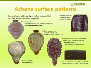
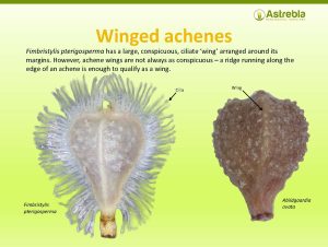
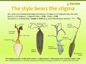
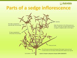
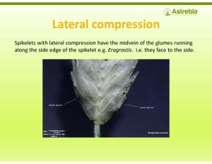
The workshop notes (see examples below) provide clear ID pointers using microscope images that will assist you in your ID endeavours for years to come!
Workshop details
Cost covers a 2 day workshop (8 am – 5 pm) – check latest price on the Humanitix website (search keyword ‘Simon Danielsen’).
You will need to take a laptop (or you can use your phone) so that you can view the digital course notes and keys.
Workshop format is simple – a presentation explaining a particular sedge genera, followed by a hands-on session with microscopes and samples of the target genera. Each student will have their own microscope & plenty of time to engage with the samples.
Class size is limited to 10 students.
Lunch (vegetarian and non-vegetarian sandwiches), snacks & morning/afternoon tea will be provided.
Each participant will be provided with detailed digital course notes including microscope photographs illustrating key features of the grass genera covered (see below).
In addition, each participant will receive to keep:
a pair of forceps for dissecting spikelets,
a pocket metal ruler ideal for use in field IDs.
Contact Simon at simon@astrebla.com or on 0423 706 440 for further information
This workshop will be run by Simon Danielsen, a field botanist & ecological consultant with over 20 years’ experience in botanical field surveys & identifications across northern Australia.
Simon has run his own ecological consultancy operation (Astrebla Ecological Services) since 2015 & is highly experienced in vegetation mapping, threatened plant surveys & the field identification of sedges, grasses & other plants. In 2014, he spent a year in the ID room at the Bangkok Forestry Herbarium in Thailand, completing over 400 botanical determinations in that time.
Search events using the keywords ‘Simon Danielsen’.
Workshops are held at The Hut, 47 Fleming Road, Chapel Hill, Brisbane.
This is the only publicly available, northern Australian grass-focused ID course based on hands-on microscope learning offered in Australia!
Learn to confidently recognise the major northern Australian grass genera & their ID features.
This workshop is designed for ecologists who conduct vegetation surveys & need to reliably identify grasses to species with scientific accuracy and consistency.
However, it is also suitable for anyone who has some background in grass ID and who wishes to extend their knowledge and skills base. Unless you are an absolute gun with IDing grasses, you will learn a lot from this workshop.
If you are a grass beginner or novice, and don’t intend to delve into the field of grass ID in future, you may find this course too detailed and fast-paced – but you are still welcome!
You will use a stereo microscope (provided) to gain familiarity with the main diagnostic feature of grasses – the spikelet. You will also gain skills in interpreting typical grass inflorescence types.
By becoming familiar with a broad range of grass spikelets, you can confidently recognise those features in the field using a simple hand lens.
At the completion of this workshop, you will:
Be familiar with the more common grass genera of northern Australia & the morphological concepts underpinning their ID (primarily C4 grasses).
Be able to recognise spikelet & inflorescence features & interpret the botanical language used to describe them.
Be able to find those features in grasses you examine in the field using a hand lens.
Be able to negotiate digital and dichotomous keys with more confidence and accuracy (and greater speed). These skills are transferable to other families.
Most importantly, you will have built a solid foundation on which to continue a lifetime of independent learning in grass identification & botany.
This is a unique opportunity to learn grass ID and microscope dissection skills from an ecologist with over 20 years’ experience.
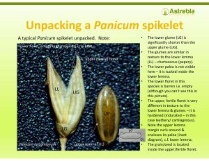
The workshop notes (see examples below) provide clear ID pointers using microscope images that will assist you in your ID endeavours for years to come!
Workshop details
Workshop cost covers a 2 day workshop (8 am – 5 pm) – check latest price on the Humanitix website (search keyword ‘Simon Danielsen’).
You will need to take a laptop (or you can use your phone) so that you can view the digital course notes and keys.
Format is simple – a presentation explaining a particular grass genera or tribe, followed by a hands-on session with microscopes and samples of the target genera/tribe. Each student will have their own microscope.
Class size is limited to 10 students.
Lunch (vegetarian and non-vegetarian sandwiches), snacks and morning/afternoon tea will be provided.
Each participant will be provided with detailed digital wprkshop notes including microscope photographs illustrating key features of the grass genera covered (see below).
In addition, each participant will receive to keep:
a pair of forceps for dissecting spikelets,
a pocket metal ruler ideal for use in field IDs.
Contact Simon at simon@astrebla.com or on 0423 706 440 for further information
This workshop will be conducted by Simon Danielsen, a field botanist & ecological consultant with 20 years’ experience in botanical field surveys & identifications across northern Australia.
Simon has run his own ecological consultancy operation (Astrebla Ecological Services) since 2015 & is highly experienced in vegetation mapping, threatened plant surveys & the field identification of grasses & other plants. In 2014, he spent a year in the ID room at the Bangkok Forestry Herbarium in Thailand, completing over 400 botanical determinations in that time.
Recently, I have been involved in surveys in the vicinity of the Eungella dam for an endangered native nightshade – Solanum graniticum.
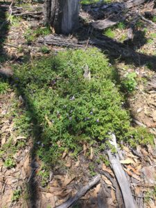
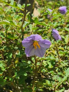
Solanum graniticum is listed as endangered under both the Queensland Nature Conservation Act 1992 and the Commonwealth EPBC Act. This species is a ‘spindly, prostrate to sprawling, herbaceous…resprouting’ subshrub in the tomato family (Solanaceae), and was named by Queensland Herbarium taxonomist Tony Bean in 2004. It was recently elevated to endangered under the EPBC Act based on a nomination submitted by Jason Halford in 2019.
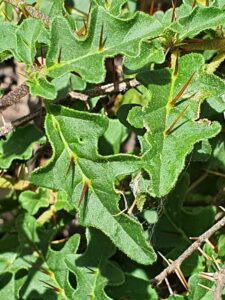
Solanum graniticum leaves
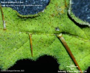
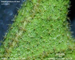
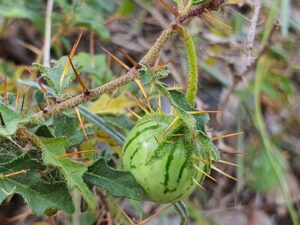
Solanum graniticum grows 20-30 cm tall, and may sprawl to a diameter of 1 m or so. It has spines to 9 mm long on the stems and the upper leaf surfaces (Bean, 2004) (and apparently on the lower leaf surface, although the specimens I examined closely did not). The leaves are shallowly to deeply lobed with 2-3 lobes per side, and are relatively small (to 2.6 x 1.3 cm). The lower leaf surface and the stems have a mid-dense to dense covering of stalked, stellate hairs. The upper surface has sparse-very sparse smaller stellate hairs (Simon Danielsen, pers obs).
This species is easily recognisable, and within its known range should not be confused with any other Solanum (Halford, 2019).
Solanum graniticum is endemic to north Queensland between Mackay and Townsville, where it is thought to be restricted to three disjunct populations (each are at least 100 km from the other). Each population is conservatively estimated to contain less than 250 individuals (i.e. the total species population is estimated at <1000 overall) (Halford, 2019):
Cape Gloucester population: Cape Gloucester is the peninsula forming the south-eastern extent of Port Denison, 22 km directly south-east of Bowen. Until our surveys, this population was thought to be the largest of the three, although the species is described as rare (Halford, 2019).
Mt Zero-Taravale population: a single collection was made in 2012 from the Mt Zero/Taravale wildlife sanctuary, 80 km west of Townsville in the Paluma hinterland (AVH, 2023). This population is 280 km from Cape Gloucester and 340 km from the Eungella dam. Population size here is unknown (estimated at less than 250 individuals at any one time – Halford, 2019).
Eungella Dam population: a handful of plants were known from two adjacent collections on a hill-top directly overlooking the dam wall, in 2003 and 2011 (AVH, 2023). Halford (2019)
Solanum graniticum upper leaf surface @ 10x
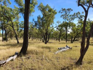
Solanum graniticum occurs in shallow soils derived from granite and granodiorite. It is most commonly associated with woodlands and open woodlands dominated by the ironbark Eucalyptus drepanophylla or E. crebra, with Corymbia erythrophloia, Lophostemon confertus, Allocasuarina littoralis and Corybia leichhardtii also noted as present in collection records (Halford, 2019; AVH, 2023).
Unfortunately for ecologists wishing to conduct targeted surveys for the species, E. drepanophylla/crebra woodland on granite soils are not in short supply in these areas, and this makes narrowing down a search area very difficult. This blog will attempt to assist this process by outlining where S. graniticum was found and my observations in relation to micro-habitat the species occupies in the vicinity of Eungella Dam (note – these observations maybe of limited value to the other two populations, in particular the Mt Zero/Taravale population).
We found 101 individuals present in 10 sub-populations occupying approximately 88 ha, within an overall local extent of occurrence of 2360 ha (and I have reliable anecdotal evidence of another 14 plants in the vicinity). All potential habitat thought present has not been covered to date and it is highly likely the population within this extent of occurrence is considerably larger. The largest sub-population found was 5.2 ha in area and contained 41 plants. Another 35 plants were recorded within a 25 ha area nearby. One plant was found on the eastern side of the Broken River, less than 100 m from the high bank, on an apron slope.
Solanum graniticum habit
Area of occurrence (AOO)
The spread of records from our surveys indicates an area of occurrence for the Eungella Dam population alone of 40 km2 (10 grid squares of 2×2 km as per the IUCN guidelines). However, using knowledge gained from these surveys in relation to habitat preference, and the distribution of that habitat type in the local landscape, I estimate that S. graniticum could have an AOO in the vicinity of the Eungella Dam of up to 80 km2.
The current documented AOO for the species is 28 km2 (Halford, 2019). Therefore, based on the findings of our surveys, total AOO for S. graniticum is now confirmed to be 68 km2, and could be as high as 108 km2 if our habitat projections are correct. This suggests that the Eungella Dam population is the prime population for the species, contributing more than 50% of the AOO.
Given these findings and their assumptions (ie that the vast majority of individuals present have been located), it is projected that the Eungella Dam population may contain 200-300 plants overall, which supports Jason Halford’s population estimate (Halford, 2019).
The extent of occurrence (EOO) for the species will not change as a result of these findings. In addition, the total estimated population size for S. graniticum of less than 1000 plants (Halford, 2019) appears to be supported.
Phenological observations
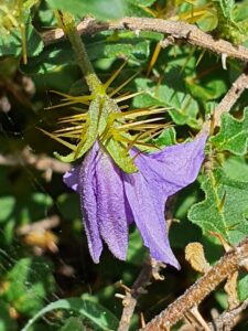
We observed S. graniticum flowering (profusely!) in November 2022. Previously, it has only been recorded flowering in March.
Solanum graniticum flowerSolanum graniticum fruit
Microhabitat and survey observations
Solanum graniticum is a sprawling, low-growing (mostly less than 20 cm high) sub-shrub that, if not flowering, is easily overlooked. It is also genuinely absent from large areas of apparently suitable habitat – habitat that is common and well-represented in the Eungella Dam area. This makes it difficult to survey for. It is sometimes present as an isolated single plant with no other individual occurring within many hundreds of metres. The highest density recorded was nearly 8 plants per hectare, but this was unusual.
The plants we recorded were always growing in the RE 11.12.1 – woodland almost entirely dominated by E. drepanophylla. Corymbia erythrophloia and/or C. dallachiana were an occasional presence (i..e associated). In places, plants grew directly adjacent to the RE 11.12.16a (woodland dominated by Corymbia citriodora), but despite searches no individuals were located in that RE. It is also possible the species occurs in the RE 11.12.7, which is E. crebra woodland with vine thicket elements, although this RE tends to occupy steep slopes, and we did not find S. graniticum on steep slopes.
Solanum graniticum habitat
The woodlands in which it was found were grassy, with the predominant ground species being the exotic pasture grass Bothriochloa pertusa* (Indian bluegrass). We did not find S. graniticum where the ground layer had a dominant native species composition. This could be because such a ground layer (dominated by Heteropogon contortus, Themeda triandra, Cymbopogon refractus etc) is taller and more complex, and S. graniticum would be much harder to spot (as noted by Jason Halford).
Ground layer species associated with our records included Aristida gracilipes, Heteropogon contortus, Rhynchosia minima, Indigofera pratensis, Cyanthilium cinereum. Lantana camara* and Lophostemon confertus were present in places.
Solanum graniticum was occasionally found in open woodland mapped as non-remnant or regrowth, but despite numerous searches in adjacent cleared habitat, it was not located where there was no tree cover.
Individuals recorded during these surveys were also always associated with gently undulating slopes, usually on broad ridgelines but also on low rises and plains. We did not record it on hillsides or in gullies except very close to the ridgeline, although there was generally suitable habitat present on the hillsides. It was also only found where there was some soil development, and was not recorded where soils were skeletal with abundant surface cobble.
In addition, the plants we found were almost invariably situated adjacent to an object – usually a fallen log or the base of a tree, but occasionally among rocks. It could be that these structures provide protection from trampling, as all the areas we found S. graniticum individuals in were grazed.
Solanum graniticum at the foot of the ironbark in foreground
References
AVH, 2023, The Australasian Virtual Herbarium, Council of Heads of Australasian Herbaria, https://avh.ala.org.au/. Accessed 3/6/2023.
Bean, A.R., 2004, The taxonomy and ecology of Solanum subg. Leptospermum (Dunal) Bitter (Solanaceae) in Queensland and far north-eastern New South Wales, Australia. Austrobaileya 6 (4): 639-816.
Halford, J.J., 2019, Nomination form to change the conservation class of Solanum graniticum in Queensland. Dept. of Environment and Science, Brisbane.
Another species on our search radar in October 2021 (see previous post about Calotis glabrescens) was the twining vine Vincetoxicum forsteri (until 2018 known as Tylophora linearis), which is listed as endangered under the EPBC Act (Cth) and the Nature Conservation Act (Qld). This very cryptic twiner of the Apocynaceae family was first described by Paul Forster of the Queensland Herbarium in 1992 from collections made in south-east Qld only four times, in 1913, 1914, 1960 and 1969 (Forster, Binns & Robertson, 2004). A small number of populations were discovered in central NSW around 2003 (Forster, Binns & Robertson, 2004), and the species is now relatively well-known in that state (where it has been collected extensively by the outstanding RPS ecologist Mark Aitkens). But until recently V. forsteri had remained elusive in Queensland since 1968.
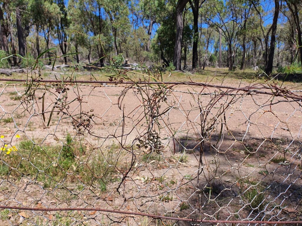
However, a GHD survey in 2018 in the Gore-Karara-Goldfields area found one individual growing on a rabbit fence on the boundary of Durakai State Forest. Therefore, during targeted protected plant surveys conducted by the Astrebla/Red Ash/GHD botany team in 2021, V. forsteri was one of the species we had high hopes of finding.
Eureka!
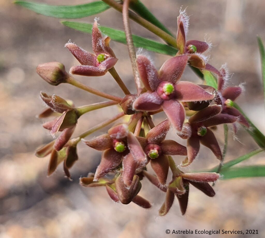
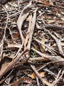
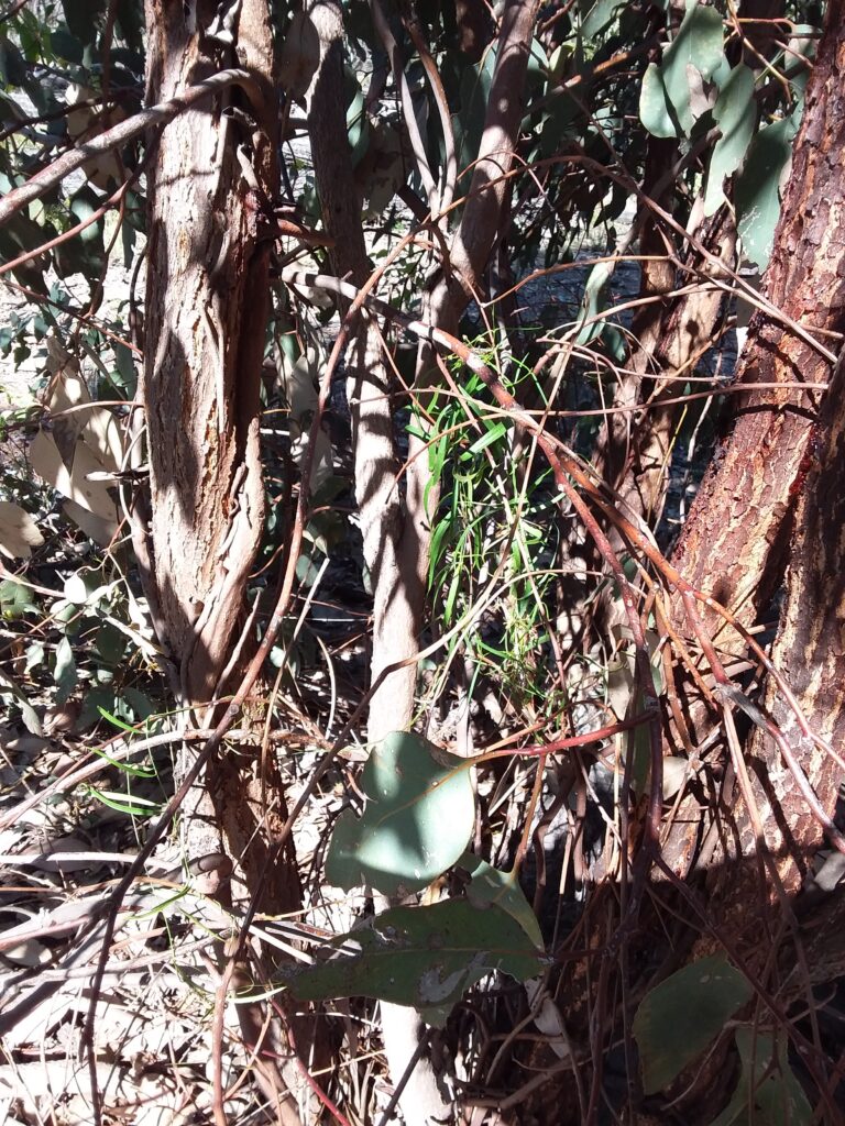
Well, we found them! Nearly 300 stems in four main populations occupying almost 90 ha. It is an extraordinarily difficult species to detect unless you slow your survey speed right down, because it is very slender (stems ~3 mm dia., leaves only a few mm wide and up to 10 cm long) (see pic below). In addition, it tends to twine up dense shrubs or coppicing trees, so is easily lost to sight among coarser vegetation. If it is flowering, the purple flowers will generally make it more easily detectable. It is my firm belief that unless protected plant surveys targeting this species are conducted at suitably slow speeds, this species will almost certainly be missed (which I’m sure occurs from time to time).
Vincetoxicum forsteri flowersA photo illustrating the very slender growth form of V. forsteri
Habitat
Our surveys found V. forsteri in two main vegetation types, open forest dominated by Eucalyptus fibrosa subsp. nubilis with E. sideroxylon (RE 13.11.5) and open forest dominated by E. dealbata with E. crebra (RE 13.11.3). We also found a number growing on the mesh fences erected decades ago to control rabbits (but none on standard barbed wire fences). Some had even started to grow on the new so-called ‘cluster fences’ recently erected across the landscape in this district with massive funding from government. These fences prevent the widespread movement of macropods and other native mammals, and I predict they will have a massively detrimental impact on many least concern species in the area – but that is a topic for another blog!
Vincetoxicum forsteri growing on a rabbit-proof fence near Durikai State Forest
We found V. forsteri stems twining in the following situations:
The most common species we found it twining on was Olearia canescens, usually dead but standing
Vincetoxicum forsteri was also frequently found climbing coppicing E. fibrosa stems (see pic – many of the areas surveyed are the subject of private logging ventures),
More uncommonly it was found climbing on Acacia leiocalyx or A. fimbriata shrubs, either alive or dead (but still standing).
In the survey area, these habitat types occur in a mosaic with open forest dominated almost exclusively by Corymbia citriodora (RE 13.11.6). We rarely found Vincetoxicum forsteri in association with C. citriodora – it appears to have a clear preference for habitat occupied by ironbarks, and E. dealbata.
We also found it along the verges of logging tracks.
Vincetoxicum forsteri has been previously associated in the main with dense shrubland (Forster et al., 2004). However, the open forest habitats in which we found these V. forsteri populations did not have dense shrub layers – in general, these open forests had very sparse to sparse shrub layers, with clear visibility for 50 m or more in most directions. We did not find any plants in the nearby areas characterised by a dense Olearia canescens shrub layer. This could be because the dense habitat makes it harder to detect, although overall 4 botanists walked just over 500 km of transects for this survey, of which at least 80 km was in areas with dense O. canescens – so these areas were well-surveyed.
Most individuals were found in areas where logging was active – although it is not known how populous the species was prior to logging, which is believed to have been practiced here for many decades.
It is interesting to note that in this area, V. forsteri is present with extensive populations of the vulnerable cycad Macrozamia conferta, another species whose populations we were mapping, and which co-occurs with forestry activities. This cycad is endemic to the Durikai-Talgai-Bringalily State Forest area, and this population is believed to be the largest on private land.
Vincetoxicum forsteri twining on a coppicing Eucalyptus fibrosaMacrozamia conferta growing in the same preferred habitat for Vincetoxicum forsteri
References
Forster, P.I., Binns, D. and Roberston, G., 2004, Rediscovery of Tylophora linearis P.I. Forster (Apocynaceae: Asclepiodoideae) from New South Wales, with revision of its conservation status to vulnerable. Austrobaileya 6 (4): 942-946.
In early October 2021, I undertook four weeks of protected plant surveys in the Karara-Cement Mills-Gore-Goldfields area, immediately to the south of Durakai State Forest, approximately 40 km west of Warwick in south-east Queensland. The surveys were undertaken in company with Carly Sugars and Peter Moonie of Red Ash Consulting, and George Brady from GHD (Astrebla was contracted to GHD for this work). In total we walked over 500 km of meandering transects during these surveys, in generally beautiful south-east Queensland spring weather! It was a complete joy!
One of the species being targeted was Calotis glabrescens C.T. White (white burr-daisy), a small daisy listed as critically endangered under the Queensland Nature Conservation Act 1992 (but not listed under the EPBC Act).
Calotis glabrescens
Presumed extinct
Until recently, this species was listed under the NC Act as presumed extinct, as there were only two records. The species had been described from one collection by Cyril T. White in 1946 (the Queensland government botanist who succeeded Bailey). White had collected the plant in late September from near Bybera, in what is now Whetstone State Forest, noting it was ‘moderately common in open forest land’. The next collection was in November 1997 by the Queensland Herbarium, who noted it was a ‘low herb to 10 cm tall with pinkish inflorescences, uncommon, scattered at site’. This collection came from approx. 18 km south-west of Leyburn.
The species was not collected again after 1997 until 2 records in 2020 (strangely, these have disappeared from AVH since November 2021), from Durikai State Forest and another site south-west of Leyburn. There are no records from outside Qld, although the excellent ‘Plants of Western NSW’ book (Cunningham, Mulham, Milthorpe & Leigh, 1992) claims there is one record from the Bourke district (Plant Net has no entry for this species, so the source of this record is unclear – it would be a substantial range extension if confirmed).
Our survey found a small population of these plants approximately 7 km south-west of Karara, just north of the Cunningham Highway (thanks to eagle-eyed Peter Moonie for finding them in the first few steps of what would be 500 km of transects!!).
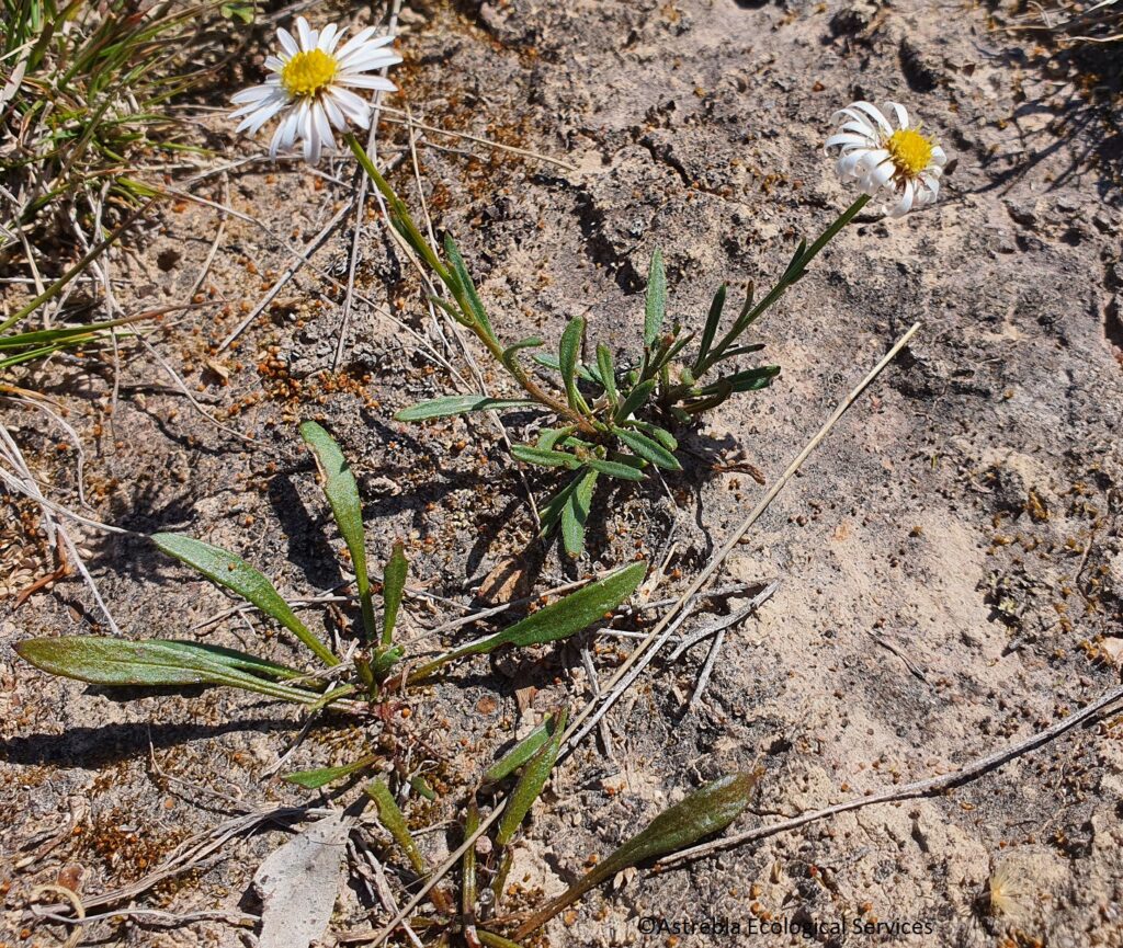
There is little recorded on this species, and no photographs are publicly available, so this blog seeks to provide sufficient information to assist in the planning of targeted surveys for Calotis glabrescens, and in its field identification.
Simon Danielsen (kneeling) and Peter Moonie (on ground) confirm the presence of Calotis glabrescens at a site near Karara
Habitat
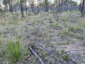
Collection records for the species associate it with open forest and semi-cleared areas containing species such as Eucalyptus moluccana, E. sideroxylon, E. viridis and the wattles Acacia montana and A. ixiophylla. The 1997 collection notes state it was found in ‘very tall woodland’ – I have visited the site of this record, and found that, using the current method for classifying vegetation communities used by the Qld Herbarium (based on Specht’s structural forms), it is not even close to ‘tall’, the canopy having a median height of approx. 15-18 m.
The 1997 collection notes also associate it with ‘traprock’ – this is a type of metamorphic rock known from the Warwick area (as with C. glabrescens, there is little to no information publicly available about this rock type).
C. glabrescens habitat at the 1997 collection site
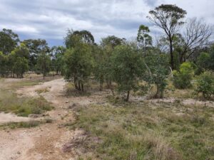
Our survey found 15 plants growing on an undulating plain beside a dirt track, on a hard-setting pale clay loam, on the edge of a large clearing (but in the clearing, not in the adjacent woodland). Adjacent woodland was co-dominated by E. moluccana and E. dealbata, and was relatively low (median height of 10-15 m). The parent rock was metamorphic and the pre-clear regional ecosystem was RE 13.11.8 (Eucalyptus melliodora and/or Eucalyptus microcarpa/ E. moluccana woodland on rolling hills, depressions and lower slopes around drainage lines, on metamorphics) (Qld Herbarium, 2021).
Habitat at our 2021 Calotis glabrescens collection site
Species identification notes
Calotis glabrescens is a small daisy growing 15-20 cm tall. It superficially resembles a number of other Calotis spp., mostly C. cuneata and C. scapigera. However, it should be relatively straightfoward to field-identify it, using the Calotis key in Keybase prepared by Ailsa Holland. There is also a useful illustration of the achenes of a number of Calotis spp. including C. glabrescens on p. 654 of Plants of Western NSW (Cunningham et al., 1992)
The major identification features (as outlined by Ailsa Holland) are:
The plant is relatively gracile – generally 15 cm tall but may extend to 20 cm, with cauline leaves and lacking a distinct basal rosette. It does not have stolons.
Flower heads are distinctly pedunculate, with peduncles >1cm long, and ray florets >2.5 mm long.
The rays are white (may be pinkish) and disc florets are yellow (see pic above).
Achenes lack scales (wings) – achene scales should be obvious, they are flaps of tissue that extend upwards from the crown of the achene.
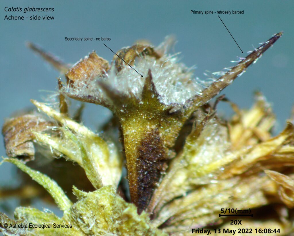
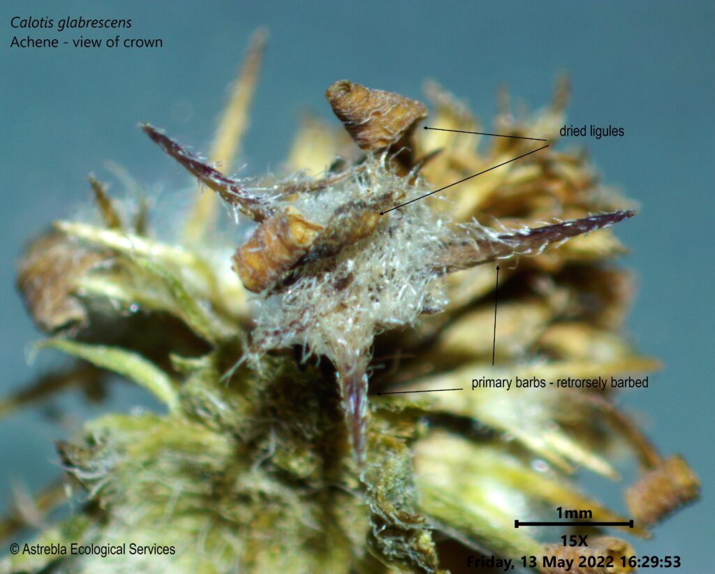
C. glabrescens achenes have 2-9 longer, rigid primary awns arranged around the outside edge of the achene crown – these awns have retrose (ie downward pointing), translucent barbs (see pics of achenes below).
In addition to the primary awns, there are several secondary awns – these lack the barbs of the longer primary awns.
In addition, the awns of C. glabrescens are NOT joined with each other at the base.
The achenes are generally as long as they are wide i.e. the horizontal and vertical axes at their longest points are approx. the same length (don’t include the spread of the awns in this measurement).
Also, look for leaves that are generally entire, but that sometimes have a single marginal tooth.
Calotis glabrescens achene – side viewCalotis glabrescens achene – top view
Survey timing
Flowers and particularly mature achenes are likely to be essential to identify this species with any certainty. Our survey was conducted in October 2021. Other collection records are from 20 September through to mid-November.
Survey challenges
This species is difficult to survey for because it is physically small and may be dwarfed by the grasses and other herbs it occurs in association with. In addition, it may be present with other superficially similar Calotis spp., which may be abundant and so may desensitise those searching, who are looking for small Calotis individuals with entire leaves and flowers with white ray florets and yellow discs. Apparently suitable habitat is also common within its geographic range – therefore, there may be large areas to cover.
Therefore, it may be easy to dismiss C. glabrescens as C. cuneataorC. scapigera (which both have stolons and serrated leaves in a basal rosette). There is only one way to survey properly for this species – slowly and carefully.
References
Australasian Virtual Herbarium (AVH), 2022, The Australasian Virtual Herbarium. Council of the Heads of Australasian Herbaria. https://avh.chah.org.au/.
Cunningham, G.M., Mulham, W.E., Milthorpe P.L. and Leigh, J.H, 1992, Plants of Western New South Wales, CSIRO Publishing, Melbourne.
Queensland Herbarium, 2021, Regional Ecosystem Description Database (REDD), version 12.0, Department of Environment and Science, Brisbane.
White, C.T., 1946, Contributions to the Queensland Flora, No. 9. Proceedings of the Royal Society of Queensland 57: 30.
But it has been a busy time at Astrebla, in fact I haven’t stopped. This period has been dominated by water projects – I have been primarily engaged during this period in providing the majority of botanical input to the following four major water infrastructure projects, for GHD and SMEC.
This project is being managed by Townsville Enterprice, with funding form the National Water Infrastructure Development Fund. Astrebla contributed botanical input to the Detailed Business Case for this project, being prepared by SMEC. Hells Gates Dam is a proposed 2110 GL dam on the Burdekin River approximately 110 km north of Charters Towers. It would supply water to 50, 000 ha of irrigated horticultural land and provide long-term water security to Charters Towers and Townsville.
Site of the proposed Hells Gate dam wall on the Burdekin River
Associated proposals are for a max 1200 MW pumped hydroelectric scheme, a 15 MW run-of-river hydro facility and a 20 MW solar farm (see the Hells Gates Feasibility Study).
The project involves a dam and four irrigation areas for high-value agriculture. The irrigation areas are proposed north of Charters Towers and west of the Burdekin River, primarily on areas of basalt and alluvial soils.
Services provided by Astrebla included a ground-truthed regional ecosystem (RE) map for the entire 270, 000 ha area – the largest ground-truthed RE map I have produced to date! This includes the dam inundation area and the irrigation areas.
The initial survey involved 13 days of helicopter surveys, followed by 14 days of ground-based surveys. Threatened plant surveys were also undertaken, during which Queensland bluegrass (Dichanthium queenslandicum) was recorded in grassland near the Basalt River – the most northerly reliable record for this species.
In addition, the Townsville botanist Chris Kahler found Acacia guymeri in the vicinity of the inundation area, which is 175 km further south than it had been recorded in north Qld previously.
Centred on the Broken and Bowen Rivers in central Queensland, the Urannah Water Scheme comprises a proposal to construct a 970, 000 ML dam on the Broken River, approximately 25 km (as the crow flies) downstream of the existing Eungella Dam. The project includes approximately 200 km of pipeline corridors to the Moranbah district, and is an integral element of two other projects, the Bowen Renewable Energy Hub (pumped hydo, wind and solar power generation) and the Collinsville Irrigation Scheme (a 20, 000 ha master-planned irrigation scheme approximately 25 km west of Collinsville).
An EIS is in the process of preparation by GHD, to whom Astrebla was contracted to provide botanical input.
Looking over the Massey Creek valley, just upstream of its confluence with the Broken River
Services provided by Astrebla included the preparation of a ground-truthed RE map for 13, 900 ha of vegetation in the proposed Collinsville Irrigation Area, and threatened flora species surveys across the entire project area.
The Broken and Bowen River catchments contain populations of black ironbox (Eucalyptus raveretiana), a species listed as vulnerable under the EPBC Act but delisted in 2012 under the Queensland Nature Conservation Act. In association with GHD ecologists, Astrebla undertook population surveys of this species, and data gained from these surveys was an important input into an application to have black ironbox delisted as vulnerable under the EPBC Act. This application was submitted to the Department of Agriculture and Environment in early 2021 and will go up for public comment and review/decision in 2022.
This project involves a proposed dam on the Palmer River, approximately 85 km south-west of Cooktown and 23 km south-west of Lakeland, in far north Queensland. The proposed dam wall is located approximately 16 km downstream of the Palmer River roadhouse (where the Mulligan Highway crosses the Palmer).
This project is being proposed by Regional Development Australia Tropical North (RDATN), with funding from the National Water Infrastructure Development Fund. It will increase the volume and reliablility of water available for agriculture in the Lakeland Irrigation Area, which was established over 70 years ago on the rich basalt soils of the Lakeland area. This water has the potential to significantly enhance the economic viability of this area without requiring further tree clearing.
Looking south from near the proposed dam wall, over the Palmer River valley
Astrebla conducted botanical surveys in association with SMEC ecologists in the proposed inundation area and pipeline corridors across a number of survey events in 2020-21. This work included the preparation of a ground-truthed RE map for SMEC over 25, 000 ha in the vicinity of the proposed inundation area, and surveys for threatened flora species.
The wattle Acacia guymeri was found in relatively large numbers in this area – this species is listed as vulnerable in Queensland but was delisted some years ago under the EPBC Act. Population surveys were undertaken, and an impact assessment completed.
The Rookwood weir project (currently being constructed) is located on the Fitzroy River approximately 55 km west of Rockhampton. It is a $367 million water infrastructure project that will have a fully supply volume of 74, 300 ML, with an impoundment length of 60 km (including the Fitzroy, Mackenzie and Dawson Rivers).
Surveying for black ironbox on the Fitzroy River
Astrebla provided botanical input to the EIS and approvals technical manager, GHD, assisting with surveys required to meet EPBC Act and Queensland government approvals. These surveys included assessments against threatened ecological community (TEC) criteria, Biocondition surveys, population surveys for the vulnerable species black ironbox, and ground-truthing over 1660 ha of RE mapping (a ground-truthed RE map was produced at 1:10, 000 over the entire impoundment area).
Its been an eventful 2 years, and I will be posting more in the coming months about some of my other work, and the interesting species I have been finding.
There has been much controversy recently in relation to Queensland’s flora trigger maps, and the requirement to commission a survey by a suitably qualified person before clearing.
It has been alleged that this law will lock up country used for grazing and farming, and make it more difficult for landowners to manage their properties. Some of the criticism has also confused things such as PMAVs and category X mapping, which are an instrument under the Vegetation Management Act, with the flora trigger map survey requirements, which fall under the Nature Conservation Act. PMAVs and category X vegetation mapping have no relevance under the Nature Conservation Act.
Flora trigger maps are aimed entirely at flora species listed as near threatened, vulnerable or endangered/critically endangered. Common flora species (labelled ‘least concern’ under the Nature Conservation Act) and plants not native to Australia are not controlled under the flora trigger map system.
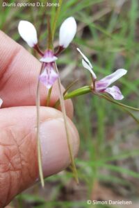
Northern donkey’s tail, a near threatened orchid from the Atherton Tableland
The flora trigger map system was put in place by the Newman government in 2014 to ensure that areas considered to be at ‘high risk’ for these protected species were surveyed before being cleared. It has been illegal to clear threatened plants in Queensland without a permit since 1992 at least – this law simply ensures that it is compulsory that areas considered to be likely to contain threatened plants are surveyed prior to clearing.
Exemptions
However, landowners should be aware that there are a number of exemptions that protect them and allow them to continue to undertake routine management activities in high risk areas without requiring a survey.
If the exemption covers your intended activity, you WILL NOT NEED a flora trigger map survey under the Flora Survey Guidelines – Protected Plants, even if the area is within a blue mapped area.
These exemptions include (accurate at the time of writing on 8 September 2019 and NOT intended to constitute legal advice) taking (ie clearing/removing/killing) a protected plant for the following…
(words in bold are those that should be taken careful note of, as they add an essential element to the interpretation of the exemption)
For grazing (Section 261P)
If the plant is consumed by grazing stock, the exemption applies to:
freehold land – if the grazing is authorised/permitted under law
other land – if the grazing is authorised/permitted under a lease, permit, license or other authority or exemption.
Routine maintenance (section 261zc)
Routine maintenance includes slashing, mowing, pruning/trimming for:
To establish or maintain a firebreak or fire management line, where:
the firebreak is to protect infrastructure (other than a fence, road or track) and is no more than 1.5 times the height of the tallest adjacent vegetation, or 20 m (whichever is the greater).
the fire management line is necessary and is no wider than 10 m.
Clearing under a self-assessable code (Section 261ZE)
If you are clearing under a self-assessable clearing code under the Vegetation Management Act 1999 section 19O (1) and (2) for:
thinning
managing weeds
managing encroachment.
To avoid or reduce the risk of serious damage (Section 261B)
To avoid or reduce the risk of serious damage to buildings or property (eg structures or personal property) where:
it is necessary and reasonable to take the plant to avoid or reduce the imminent risk of serious damage, AND
If the damage is not prevented or controlled, a person may suffer significant economic loss, AND
the taking cannot reasonably be avoided or minimised.
By fire under the Fire & Emergency Services Act (S.261C)
If the clearing is done under the Fire and Emergency Services Act 1990, where:
it is part of a reasonable action by an authorised fire officer as defined under that Act, OR
the person takes the plant by lighting a fire that is authorised under a notification or permit issued under the Fire and Emergency Services Act 1990, and that fire is necessary for hazard reduction.
There is also an exemption for taking protected plants for fodder (section 261U), but it does not apply to endangered or vulnerable plants.
NOTE – THE ABOVE IS OFFERED FOR GENERAL INFORMATION ONLY AND DOES NOT CONSTITUTE LEGAL ADVICE.
ALWAYS CONSULT THE RELEVANT ACT AND/OR A GOVERNMENT OFFICER AND/OR YOUR LEGAL ADVISOR PRIOR TO CLEARING.
Clearing that does not meet the exemptions
If your clearing does not meet any of the exemptions (see the Nature Conservation (Wildlife Management) Regulation 2006 for the full list), you should obtain a flora trigger map for the intended clearing area from:
Under section 261z, if your clearing area is NOT mapped as a high risk area, you can clear without a survey provided:
you are not aware of the presence of any threatened plants in the area to be cleared,
you clear within 12 months of the date of receiving the flora trigger map,
you keep the flora trigger map in your records for at least 5 years from the date the clearing starts.
Of course, you must also satisfy yourself that the clearing is legal under other applicable laws, in particular the Vegetation Management Act.
If your clearing area IS within a mapped as a high risk area (and doesn’t meet an exemption), you will be required to commission a flora survey by a suitably qualified person.
If that survey finds that threatened plants are NOT present, you simply submit the survey report to the government at least one week prior to the clearing commencement date, and no later than 12 months after the flora survey was completed.
If threatened plants are present, it may be possible to plan the clearing such that it can be demonstrated those plants will not be impacted. Alternatively, an offset may be acceptable.
Engaging a ‘suitably qualified person’
If your clearing area is within a mapped high risk area AND doesn’t fall under an exemption, you must commission a survey by a suitably qualified person.
You should always ask this person to prove they are suitably qualified prior to engaging them – a suitably qualified person must meet the requirements outlined in section 4 of the Flora Survey Guidelines, available at:
Ideally, this person will be able to produce a pre-approval letter from the Chief Executive of the Department of Environment and Science agreeing that they are a suitably qualified person. In addition, they should have completed similar flora trigger map surveys previously.
I have pre-approval as a suitably qualified person under the Flora Survey Guidelines and have conducted over 30 flora trigger map surveys since 2015. If you wish to discuss your flora trigger map survey requirements, please don’t hesitate to contact me on:
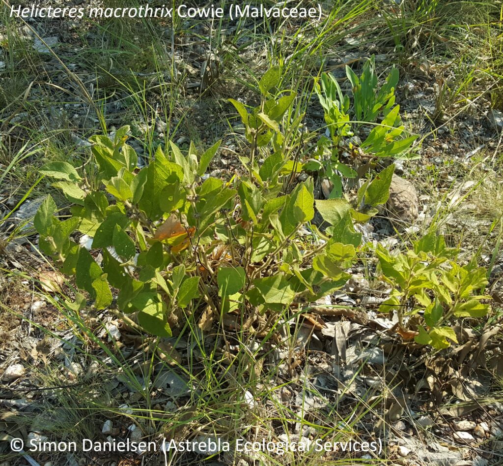
In May 2019 I conducted a survey with Chris Brock from Brock Environmental for the threatened shrub Helicteres macrothrix (Malvaceae) Cowie – previously known as Helicteres sp. Glenluckie Creek (N.B. Byrnes 1280).
This species is listed as endangered under both Northern Territory and Commonwealth legislation.
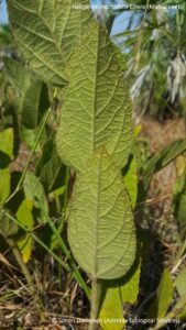
H. macrothrix is an erect, densely clumping subshrub growing to approximately 60 cm tall. The leaves and stems are covered with a dense indumentum of long, stellate trichomes (= hairs) with a diameter up to 4.5 mm wide (Cowie, I., 2011).
It is restricted to a small area approximately 80 km south east of Darwin, where it has been recorded from three main sub-populations in the Mt Bundey, Coomalie Creek and Lake Bennett areas (with an outlier north of Acacia Hills) (Australasian Virtual Herbarium, 2019).
Our survey was located north of Lake Bennett. As is often the case with threatened species surveys, the timing of the survey (late wet season/early dry season) and prior weather conditions (the Top End had a very dry wet season this year) were not optimal for flowering. However, we were pleased to find that this species appears to be quite readily identifiable (and observable) well into the dry season, in the absence of reproductive material and even after burning.
We found it closely associated with a combination of Eucalyptus tectifica woodland with Wildman siltstone (the latter being an early Proterozoic metamorphosed siltstone), growing among a tall, dense to sparse grassy ground layer generally dominated by Sarga intrans and Heteropogon triticeus with Schizachyrium fragile.
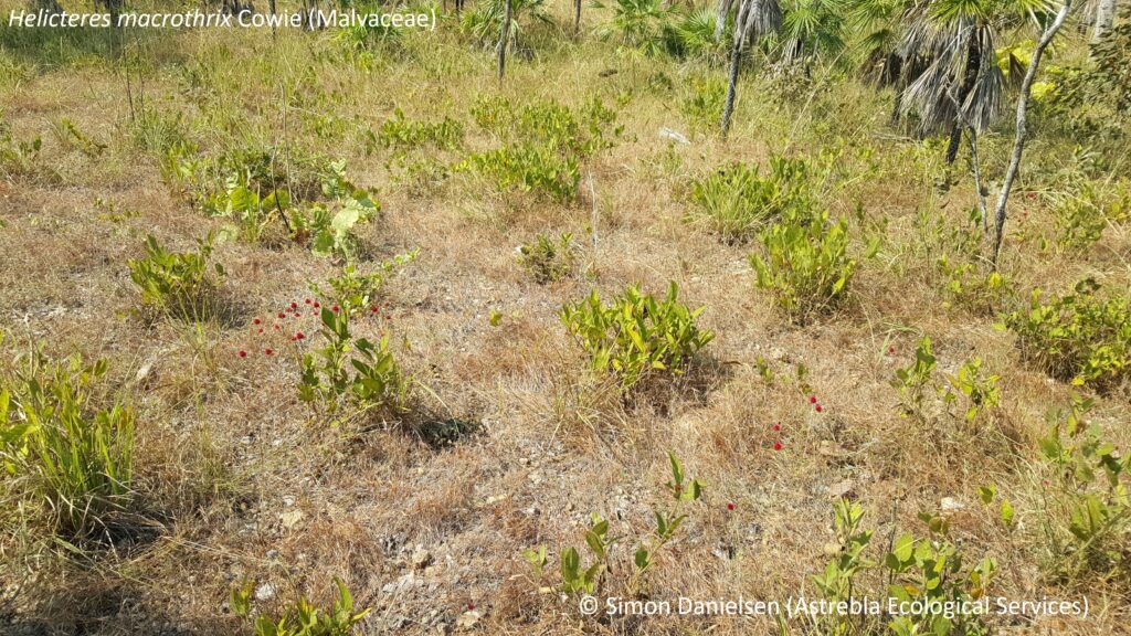
It was always present in lower landscape positions, on gently undulating run-on surfaces or on level plains isolated from adjacent slopes.
In general, it was growing in sparse to mid-dense groups (see picture above), but occasional outlying individual plants were observed, sometimes many hundreds of metres from the main population. However, within our survey area it was unfailingly associated with E. tectifica.
Some parts of our site had been burnt a few weeks prior to our survey. However, H. macrothrix appears to be one of the first plants to recover after fire, and sprouts that were identifiable to species and already a few inches tall were easily observable.
In fact, H. macrothrix regrowth was obvious in this situation, given that little other regrowth had yet occurred.
H. macrothrix is superficially similar to H. darwinensis and H. integrifolia but can be discriminated relatively easily from these in the absence of reproductive material, as it has:
an erect, multi-stemmed habit – c.f. H. darwinensis, a prostrate species,
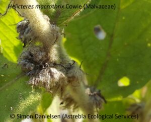
crowded inflorescences (see picture above – the spent calyces are persistent),
very coarse, congested stellate hairs (macrothrix = large hairs) to 4.5 mm dia. – much larger than both H. darwinensis and H. integrifolia.
In addition, H. macrothrix is not associated with laterite (c.f. H. darwinensis) and only grows in sandy soils that are derived from granite (c.f. H. integrifolia).
The Northern Territory Herbarium (DNA) has prepared a number of excellent resources on this species, and should be consulted in relation to ID questions and in relation to survey design – in particular see:


 I have pre-approval as a suitably qualified person under the Flora Survey Guidelines and have conducted over 30 flora trigger map surveys since 2015. If you wish to discuss your flora trigger map survey requirements, please don’t hesitate to contact me on: